Geospatial information for Defence, Security & intelligence
The global and diverse nature of threats to our security has never been so great and it has long been recognised that geospatial information provides a unique perspective to assist in understanding this environment. It is also widely recognised that the commercial world should play an increasingly important role in supporting Governments and Agencies in combating threats and enhancing our understanding.
How can Earth-i help?
Earth-i is uniquely positioned to provide elements of this support, using the full range of high resolution commercial satellite imagery available to us. By taking and end-to-end approach, we provide an agile and responsive service to the Defence, Security and Intelligence sectors.
We are investing a significant amount of resource into pushing the boundaries of machine-learning in support of the defence, security and intelligence (DSI) sectors, specifically on automated object recognition, change detection and rapid and accurate 3D modelling, all of which are particularly suited to colour video. This will elevate the analyst to focus on the ‘so what’ and the ‘what if’ and enable greater situational awareness and predictive intelligence.
Applications
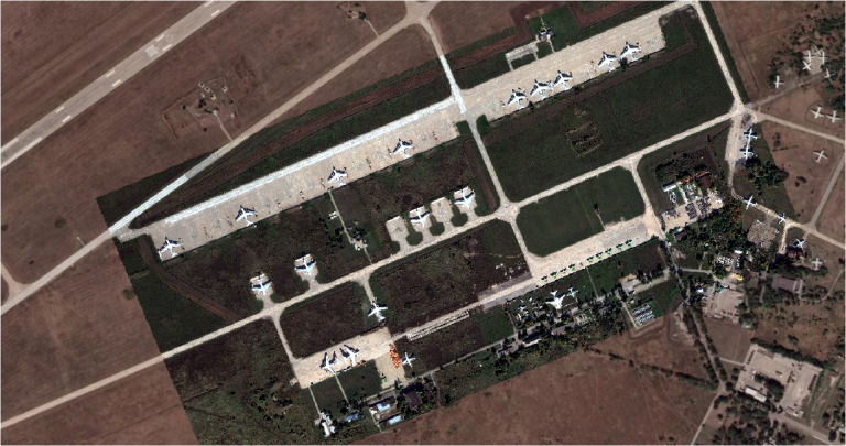
The practical applications of the Earth-i capability for the DSI community are many and varied, and by working collaboratively with DSI organisations, we are able to optimise these. They include strategic overwatch, indicators and warning, crisis support, and establishing pattern of life, in addition to the more routine but equally important provision of foundational intelligence (ORBATs, infrastructure, logistics nodes etc).
Read the white paper
For more insight, you may wish to read our White Paper, entitled: Intelligence as a Service. Time to Change the Approach? Written by Sean Corbett, CB, MBE, this highlights the game-changing opportunities presented by Earth Observation.