A guide to satellite image data
This short guide will give you an outline of satellite image data, to help with selecting data for your Earth Observation project.
Satellite data is available in a wide range of bands and resolutions. It can be obtained in a range of coverage areas and re-visit rates (including historic data). It can be sourced from many operators, each with different options and prices.
For any particular use-case, a key task is to select the most appropriate band, resolution, coverage area, revisit rate and supplier to achieve your goal at an optimal cost.
This guide will identify some of the basic considerations. We take customers through these in some detail during consultation and solution design and we would be delighted to discuss the concepts with you, either informally or in more detail during your buying process.
Sensor type
Alongside optical satellite imagery, there are also other satellite sensor types – radar, infrared and more. These are used in a variety of applications such as for pollution and weather monitoring. Infrared sensors can detect fires, hot spots in industrial and chemical production processes and even warm buildings. SAR (Synthetic Aperture Radar) can help with detecting vehicles, which help detect when car and lorry parks are full, and in turn when plants are in operation.
It is often helpful to mix information from different bands of the electromagnetic spectrum (eg optical with radar or infrared), or from non-satellite data (eg drone footage).
When designing solutions we consider all sensor types to identify a blend that will optimise performance and cost.
Resolution
Satellite data resolution is specified using Ground Sampling Distance (GSD), measured in metres. Satellite imagery of 0.3m GSD means that each pixel covers 30cm x 30cm of the Earth. Here are some typical resolutions that you might come across.
| Type of satellite | Resolution |
| Weather | > 100m |
| Wide area for agriculture | 10 to 25m |
| Medium Resolution (MR) | 2 to 10m |
| High Resolution (HR) | 0.5 to 2m |
| Very High Resolution (VHR) | < 0.5m |
Resolution requirements for Detection and Classification
Common requirements for satellite data are to detect an object (to identify what it is) and to classify it (to identify what type it is). One can intuitively see that higher resolutions make this easier to achieve by enabling smaller features to be detected and classified.
Increasing the resolution usually increases the cost, so one typically acquires the lowest resolution that will achieve the objective. We use AI and machine learning to achieve better detection and classification, which can help with the performance and cost of your solution.
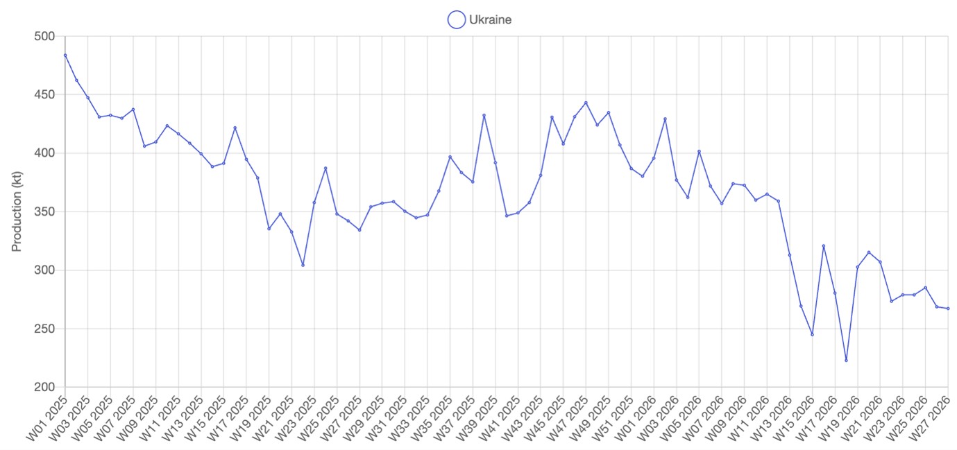
Data frequency and age
With Earth Observation we usually want to recognise changes over time. We can make our change detection more responsive by increasing the revisit rate, but this also increases the cost.
When baselining a project we can use archive data, that will be cheaper than new tasking.
Coverage
You can typically request a single image, or a campaign to monitor a specific area of interest (AOI) over time.
Depending upon the satellite operator, data is usually sold by the Square km. Archive material is commonly available with a minimum order of 25 km2, with new tasking at a minimum of 100 km2. However, with our broad supply base and operator experience, we are usually able to provide data in smaller areas.
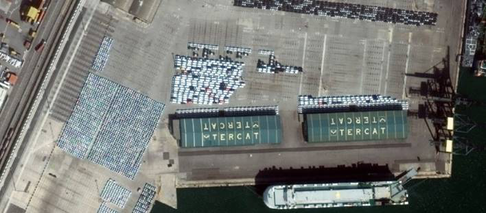
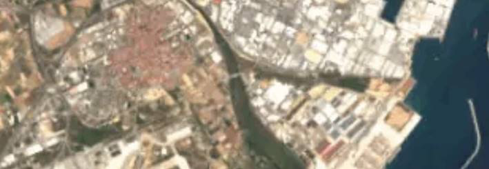
Example images
Here are some example images to show the level of detail available from optical images at varying resolutions.
15M GSD – Low Resolution
3M GSD – Medium Resolution
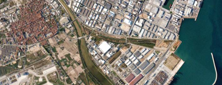
1M GSD – High Resolution
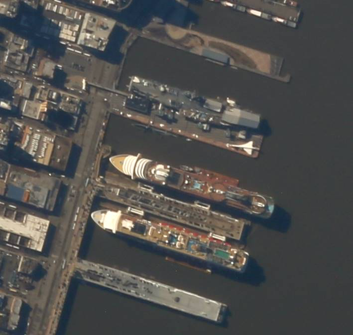
0.8M GSD – High Resolution
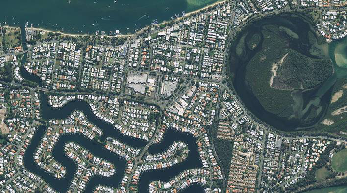
0.5M GSD – Very High Resolution
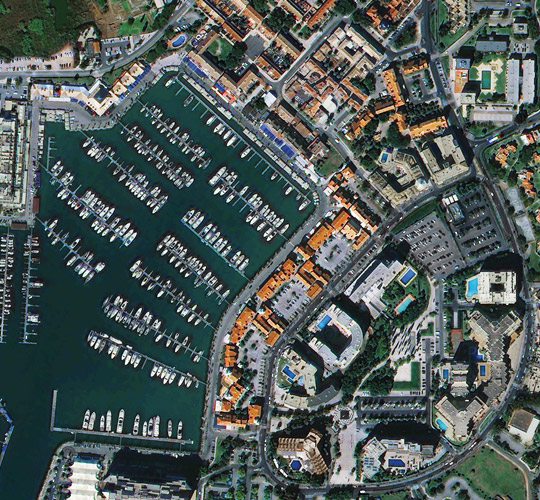
0.3M GSD – Very High Resolution