In summary
We investigated the application of Earth Observation remote sensing to improve agriculture practices across a region within India.
The requirement
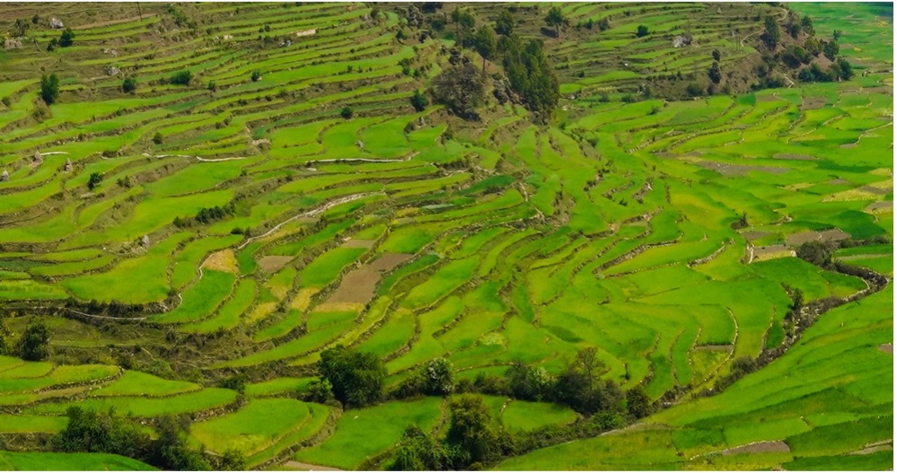
62% of families in the region are dependent on agriculture and allied sectors. Farmers in this region face many challenges, and it was recognised at government level that their income didn’t balance with production costs. The region’s agronomists were in need of innovative solutions to overcome an increasingly competitive local market.
The consultancy project
We undertook a desktop study to collect information and advise which themes could strongly benefit from Earth Observation and analysis, to form recommendations for a pilot study targeting strategic improvement, both locally and at scale.
This was cross referenced with our knowledge of which satellite imaging resources would be appropriate, as well as which experts and subcontractors should be involved to form a better situational picture, creating a system to record, analyse and disseminate the intelligence. This allowed for more informed recommendations, interventions and better decisions moving forward.
The scope
The desktop study looked at the following areas:
- Characteristics of the major crop types grown in region
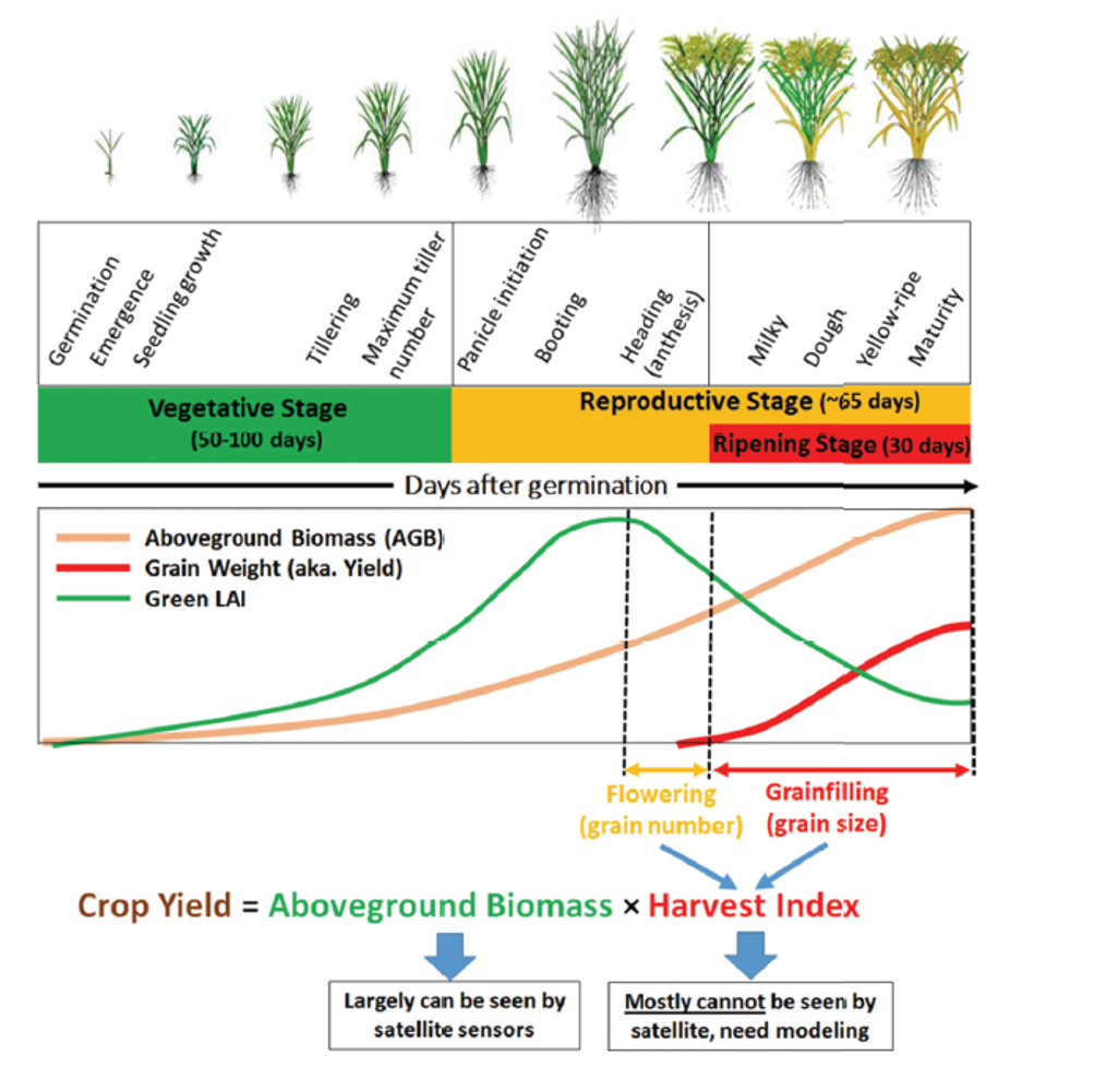
- Growth monitoring and yield estimates
- Crop health warnings
- Historic studies
- Seasonal variation
- Environmental and sustainability impact
The study
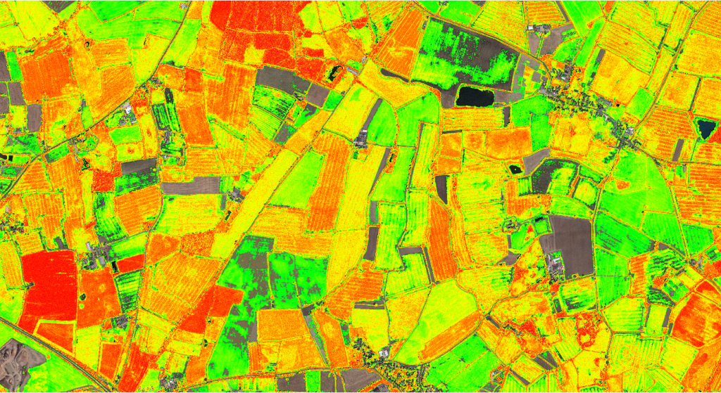
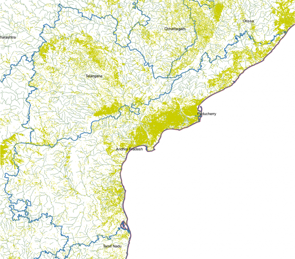
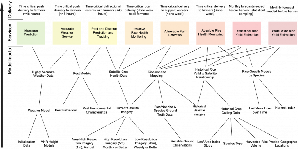
We sourced multiple independent data sets with which to conduct the study, and used these to support our analysis and recommendations. Key inputs included:
Crop health maps
Crop maps
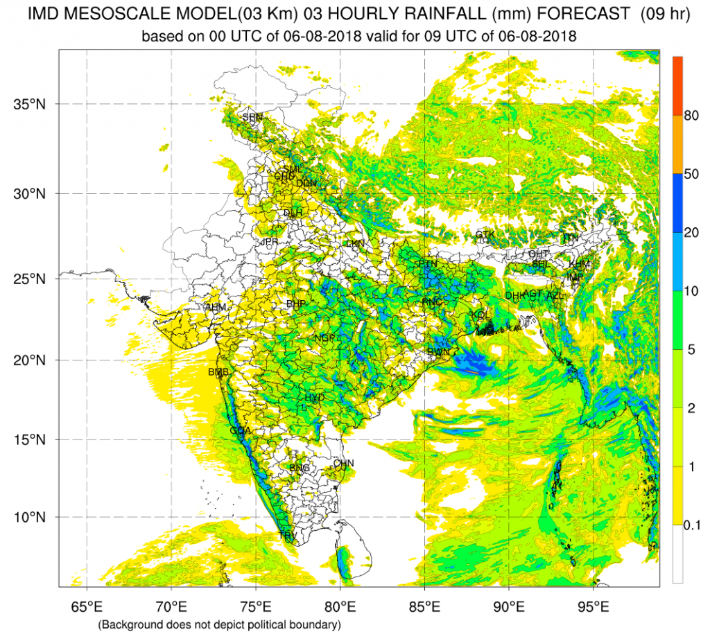
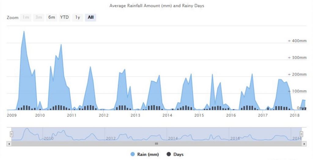
Rainfall predictions
Crop yield models
Data Sourcing and Processing Models
The output
The output was a report containing
- Recommendations on the major theme to be addressed by satellite imagery-based precision agriculture
- The additional information and partnerships required for building a big picture system
- Recommendations on what would be required from the government, agronomists and local farmers.