The Brief
We undertook a project to prove the utility of satellite Earth Observation in detecting and evaluating risks to power grid infrastructure.
This consisted pylons, along with primary power transmission cables; substations; transformers; secondary transmission cables and related grid facilities such as maintenance buildings.
The Deliverables
The primary deliverables were to offer information about the situation of and risk to the pylons supporting the electricity distribution system. In parallel the project built a deeper level of analytics to provide more real time and risk services.
The aim was to demonstrate services, in anticipation of scaling these services up to a wider land area using advanced semi-automated imagery and data analytics, to provide the most relevant insights on the power grid status at any time.
The project assessed a number of features, such as:
| River extent | Evaluate risk to pylons from the changing conditions of waterways |
| Trees and vegetation | Monitor the growth of vegetation and agricultural land use around pylons and along the power line route |
| Power line wind threat | Assess risk dependent on the length of power line runs based on historical high wind conditions |
| Building and development | Provide information on changing land use, building work and other activity around power lines |
| Storm alert and damage risk | Combine real time weather with other threat layers to provide risk alerts to sections of the line |
| Flood risk | Use 3D modelling to evaluate risk based on the previous layers and together with alerts |
| Lightning impact | Monitor real time lightning and alerts when strikes occur near to transmission infrastructure |
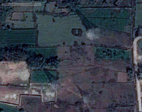
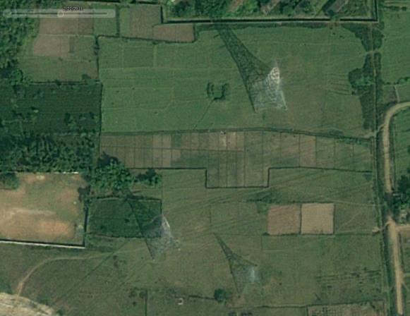
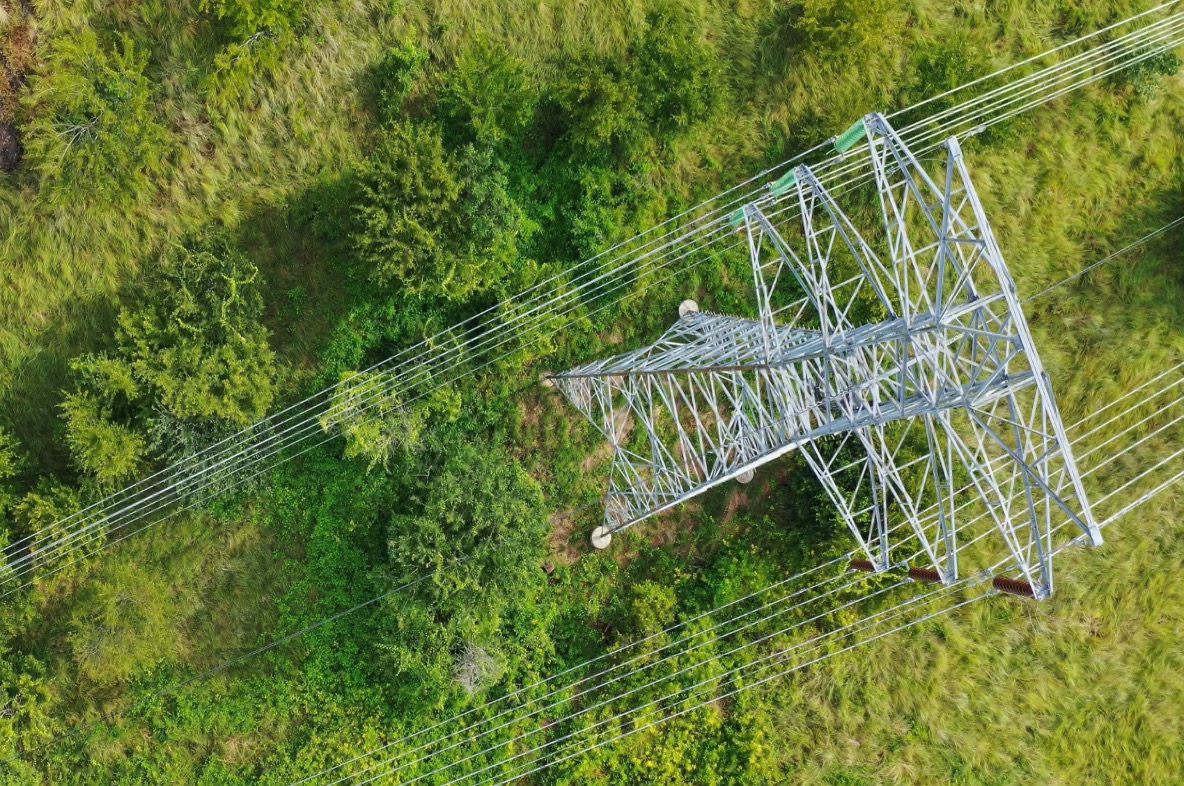
The images below show pre- and post-installation, showing building work under pylons and vegetation encroachment on a major power line.