Earth-i welcomes Carlos Berná-Esteban to strengthen the Technology Team
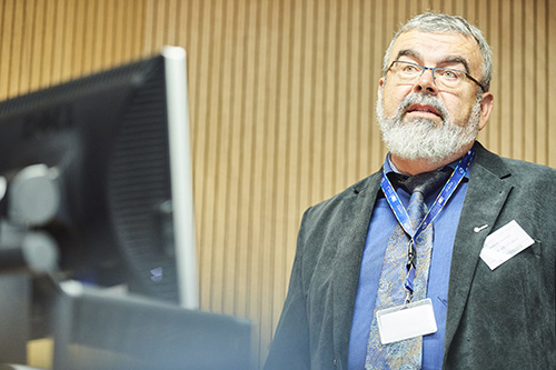
29th October 2020 – Earth-i welcomes Carlos Berná-Esteban to the Earth-i Technology team. Carlos joins the team from Unisys and has a wealth of commercial experience of projects in the public sector and finance industry.
“I am very excited to bring my data science and machine learning expertise into the remote sensing arena. Earth-i is committed to unlock the power of satellite data insights and find smart innovative ways to resolve day-to-day problems and I could not be happier to be part of this journey”, commented Carlos.
Carlos joins a team of remote sensing, GIS, developer and data science experts who are working on fusing multi-sensor and multi-resolution earth observation datasets with the latest AI techniques to deliver proactive commercial insights.
Richard Pearce, CFO of Earth-i, said “We welcome Carlos and his wealth of experience and positivity to the Earth-i team. We continue to strengthen our multi-disciplinary Technology team in conjunction with bringing new geospatial insight and analytic products to the market and looking to consistently develop and augment these. These products include our recently launched SPECTRUM risk monitoring platform, as well as SAVANT, providing global copper smelter insights, where we are delighted to be in partnership with Marex Spectron.”
About Earth-i
Earth-i is an innovative British Geospatial Information provider fusing multi-operator, multi-resolution, multi-sensor Earth Observation (EO) data including satellite video coupled with advanced analytics and geospatial experts to provide near-real time actionable insights.
To find out more please visit www.earthi.space.
For more information about this press release, please contact: info@earthi.space.co.uk
#infrastructureprojects #constructionsector #infrastructure #earthobservation #highways #buildingindustry #constructionuk #remotesensing #geospatialdata #geotechnicalengineering
Earth Observation specialist brings over 25 years technology and applications experience to company offering daily high-resolution imaging and data…


