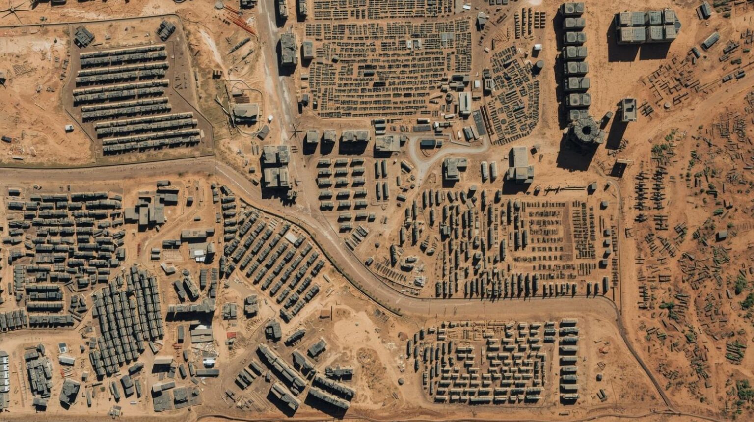
Satellite data benefits the military by enabling armed forces to observe activity across large areas, track changes over time, and build a more precise understanding of the operational environment. This intelligence supports decision making before, during and after military operations.
Satellite data contributes across a wide range of military functions. This article focuses on its role in situational awareness, early warning, targeting support, logistics and battle damage assessment, while recognising that it is most effective when combined with other intelligence sources.
How does satellite data improve military situational awareness?
Situational awareness is improved by providing forces with a wide and regularly updated view of the operational environment. Commanders need to understand force disposition, terrain constraints, infrastructure status and how conditions are evolving. Satellite imagery and derived data help build that picture. They can reveal troop concentrations, defensive preparations, vehicle dispersal, activity at airfields, movement through ports, and changes around critical facilities. Optical imagery provides detailed visual information when conditions allow, while radar imagery enables collection through cloud and in darkness, ensuring more consistent coverage.
The principal advantage lies in wide area, repeatable observation. Satellites allow analysts to place local developments within a broader operational pattern and assess how activity evolves over time. This supports a more structured understanding of the battlespace rather than isolated observations.
How does satellite data support early warning?
Early warning is supported by identifying observable indicators of preparation before military activity begins. Armed forces typically generate detectable signatures as they transition towards operations. Vehicles concentrate, logistics activity increases, air assets reposition, engineering work expands and temporary infrastructure appears.
Satellite data enables these indicators to be detected and assessed across multiple locations. More importantly, it supports the identification of sustained patterns rather than isolated events. This distinction is critical. Individual movements may be routine, but coordinated changes across regions can indicate mobilisation or imminent action.
This extends decision time for military and political leaders, allowing for reinforcement, signalling or deterrence measures. In this way, satellite data contributes to indications and warning frameworks that shape responses before events fully unfold.
What role does satellite data play in targeting support?
Satellite data plays an important role in targeting support by helping to identify potential targets, confirm their location and understand their operational context. Targets exist within systems that include infrastructure, support assets, defensive measures and surrounding environments. Earth observation supports the development of target intelligence by revealing fixed installations, logistics nodes, transport networks, air defence positions and patterns of activity. It can also provide insight into whether a target appears active, hardened, concealed or potentially deceptive.
Satellite data does not function in isolation. It is one component within a broader intelligence process that may include signals intelligence, airborne collection and other sources. Its value lies in providing consistent geographic coverage and a stable reference framework that supports planning, particularly for operations conducted at distance.
How does satellite data help military logistics?
Satellite data provides visibility of the infrastructure and networks that sustain military operations. Logistics determine the endurance and effectiveness of a force, even when it is less immediately visible than combat activity. Through wide area observation, satellite data supports the assessment of roads, railways, ports, bridges, storage facilities, airfields and fuel infrastructure.
Analysts can identify viable routes, alternative pathways, bottlenecks, congestion and damage that may affect movement. It also enables monitoring of whether an opposing force is maintaining supply lines or experiencing disruption. In regions where access is limited or contested, satellite data may provide the only consistent means of assessing logistical capacity.
Understanding logistics at scale often provides a clearer indication of operational intent and sustainability than focusing solely on frontline units.
How does satellite data support battle damage assessment?
Satellite data supports battle damage assessment by enabling analysis of physical changes following an operation and helping determine whether the intended effect has been achieved.
Imagery can reveal structural damage, impact points, debris, burn marks and disruption to infrastructure. It can also indicate whether activity resumes, whether repairs are underway or whether assets were relocated prior to a strike. This supports more accurate assessments of whether a target has been destroyed, degraded or remains functional.
Reliable assessment reduces unnecessary repeat actions and improves the efficient use of resources, while also informing escalation decisions.
Constraints and considerations
Satellite data has important limitations. Collection is constrained by revisit rates, tasking priorities and the resolution of available systems. While radar imagery improves access in challenging conditions, interpretation can be complex and may require specialist analysis. Adversaries can also employ concealment, deception and dispersion to reduce visibility. Underground facilities, emissions control and deliberate decoy activity can further complicate interpretation.
In addition, the volume of data generated by modern satellite systems creates analytical challenges, requiring effective processing and prioritisation.
For these reasons, satellite data is most effective when integrated with other intelligence sources and assessed within a broader analytical framework.
Future developments
The role of satellite data in military operations is evolving. Increasing numbers of satellites in low Earth orbit are improving revisit rates and enabling more persistent observation. Advances in data processing and machine learning are supporting automated change detection and pattern analysis at scale. There is also a shift towards more rapid dissemination of satellite-derived insights to operational users, reducing the time between collection and decision.
At the same time, the space domain is becoming more contested, with greater emphasis on resilience, redundancy and protection against interference. These developments are likely to increase both the value and the complexity of satellite data within military decision making.
Satellite data enables structured observation of the operational environment across time and space. It supports situational awareness, strengthens early warning, informs targeting, clarifies logistics and enables assessment of outcomes. Its effectiveness depends on how well it is integrated with other sources and how its limitations are understood. As capabilities evolve, satellite data will remain a central component of military intelligence, providing a foundation for more informed and timely decisions.


