By Peter Hausknecht for The Geological Remote Sensing Group newsletter. Issue 75 | September 2016
The last few years have seen an accelerated provision of very high resolution satellite data* by a number of providers in the commercial satellite data supply world. Since 2015 satellites produced by SSTL in the UK are part of this family, with the launch of 3 identical DMC3 satellites providing multispectral images with a panchromatic channel better than 1 metre spatial resolution. The high agility and revisit rate provide for imaging opportunities of every place on earth at least once a day – cloud cover depending. Looking also at all the other suppliers the availability of high resolution satellite data is better than ever. But do we really need that? And since one has to pay commercial rates is that value for money or are the new 10m Sentinel-2 data the new norm with enough information? The answer is yes and no – application depending. However, in most cases a high resolution satellite data set should be part of the baseline mapping exercise to fully understand the area in question.
Using some examples:
– If one provides a base map for a geological / exploration field campaign the high resolution satellite imagery will also act a planning tool for the campaign logistics, roads, campsites, access points etc., often also requiring a high resolution elevation model, derivable in some cases through the same satellite data. In addition, the Health & Safety aspects demand recent data for planning and an older image may not fulfil such requirements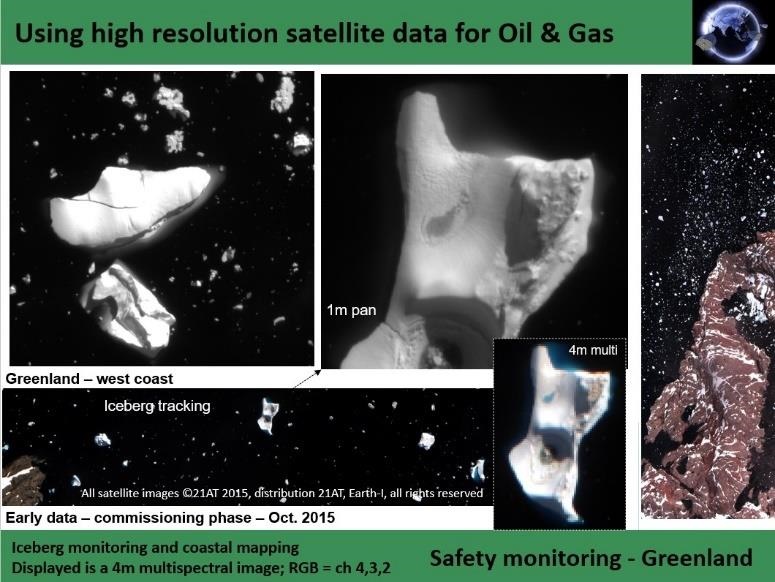
– For an environmental impact assessment of a new mine site, monitoring is often required and even this ongoing monitoring may be achieved with Sentinel / LandSat type data in some cases. But most often the baseline map needs the high spatial resolution detail to address individual conservation aspects, and if changes occur this data set acts as an important reference tool.
– Emergency response along our UK and international coastlines is a third aspect for the need of high resolution data. It has been demonstrated in the past that any oil spill response and clean up activity will dramatically improve with the availability of high resolution base maps. Hence for the best possible preparedness level we need the best possible maps based on very high resolution data, which in remote areas are more effectively derived from satellites rather than from aerial surveys.
Demonstrating the DMC3/TripleSat high resolution data capability we show some image examples from the west coast of Greenland, which is often in the news being close to the next frontier in oil and gas exploration – but for now we anticipate that will be on hold until the oil prices recover further.


