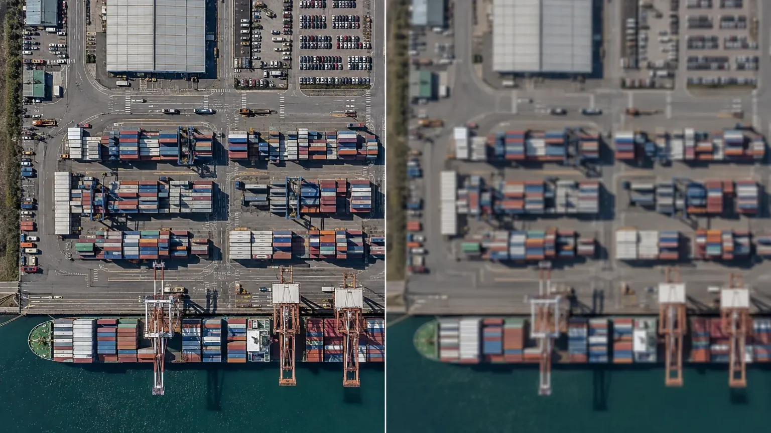
Resolution is one of the first specifications people look at when assessing satellite imagery. Yet it is also one of the most misunderstood. As the commercial Earth observation industry pushes towards Very Very High Resolution, or VVHR, imagery below 0.3 metres, it is tempting to assume that finer detail automatically means better data.
That is rarely the case.
At Earth-i, our view is that satellite data should have sufficient resolution to answer the commercial question being asked. Going beyond that point can increase data costs, processing requirements and analytical complexity without delivering a better answer.
A single source of satellite data will also answer relatively few questions. The strongest geospatial intelligence often comes from selecting the right resolution and combining it with other relevant datasets.
What is spatial resolution in satellite imagery?
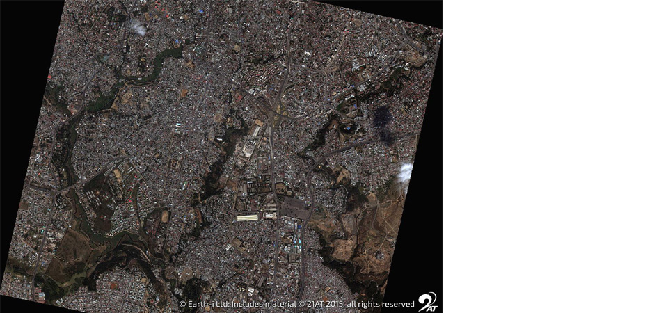
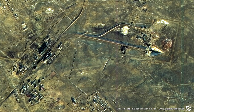
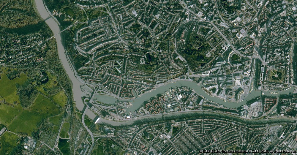
Spatial resolution describes the level of detail visible in an image, expressed as the area of ground represented by each pixel.
Broadly, Earth-i uses the following categories to classify satellite imagery by spatial resolution:
Resolution category | Abbreviation | Spatial resolution | Relative cost | Typical applications |
Very Very High Resolution | VVHR | Below 0.3 metres | ££££ | Defence, intelligence, precision mapping |
Very High Resolution | VHR | 0.3 to 1 metre | ££££ | Urban monitoring, infrastructure assessment, change detection |
High Resolution | HR | 1 to 5 metres | ££ | Construction monitoring, port and airport activity |
Medium Resolution | MR | 5 to 30 metres | £ | Crop monitoring, deforestation, large-area environmental change |
Low Resolution | LR | Above 30 metres | £ | Weather systems, ocean monitoring, large-scale environmental surveys |
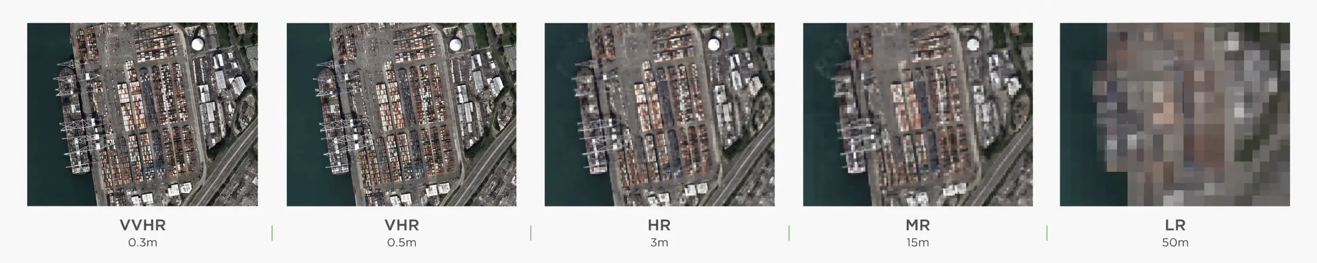 VVHR imagery can reveal extremely fine features and is particularly valuable for defence, intelligence and detailed mapping. At the other end of the scale, LR imagery is well suited to monitoring large areas, including environmental change and weather systems, often at considerably lower cost.
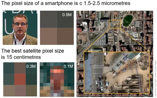
Archive availability matters too. Significant historical archives are much more common for HR, MR and LR imagery. For applications that depend on analysing change over many years, archive depth may matter more than achieving the finest possible spatial resolution.
Types of satellite data resolution – looking beyond pixel size
Two satellite operators may specify the same nominal spatial resolution for their imagery, but the resulting data can differ significantly in quality and other characteristics. Spatial resolution is therefore only one measure of data quality in remote sensing and Earth observation.
Other important resolution types include:
- Temporal resolution describes how frequently a satellite can observe an area. Frequent revisits are essential where conditions change rapidly, such as crop development, construction activity or industrial operations.
- Radiometric resolution measures how sensitively a sensor can distinguish small differences in recorded energy or brightness. Greater sensitivity can reveal subtle variations that may be invisible in imagery with lower radiometric performance.
- Spectral resolution concerns the wavelengths a sensor records. A multispectral system capturing several carefully selected spectral bands can provide information about vegetation, water, minerals or materials that cannot be obtained from spatial detail alone.
- Signal to noise ratio (SNR) is equally important. A higher SNR generally produces cleaner measurements in which the useful signal is more clearly distinguishable from background noise.
What is ground sample distance (GSD) in satellite imagery?
Ground Sample Distance (GSD) is the distance between the centres of neighbouring pixels as measured on the ground at the time of image acquisition.
GSD is not necessarily constant for a satellite platform and may even vary across a single image. Understanding GSD is essential when comparing imagery from different satellite operators, even where their advertised spatial resolution appears similar.
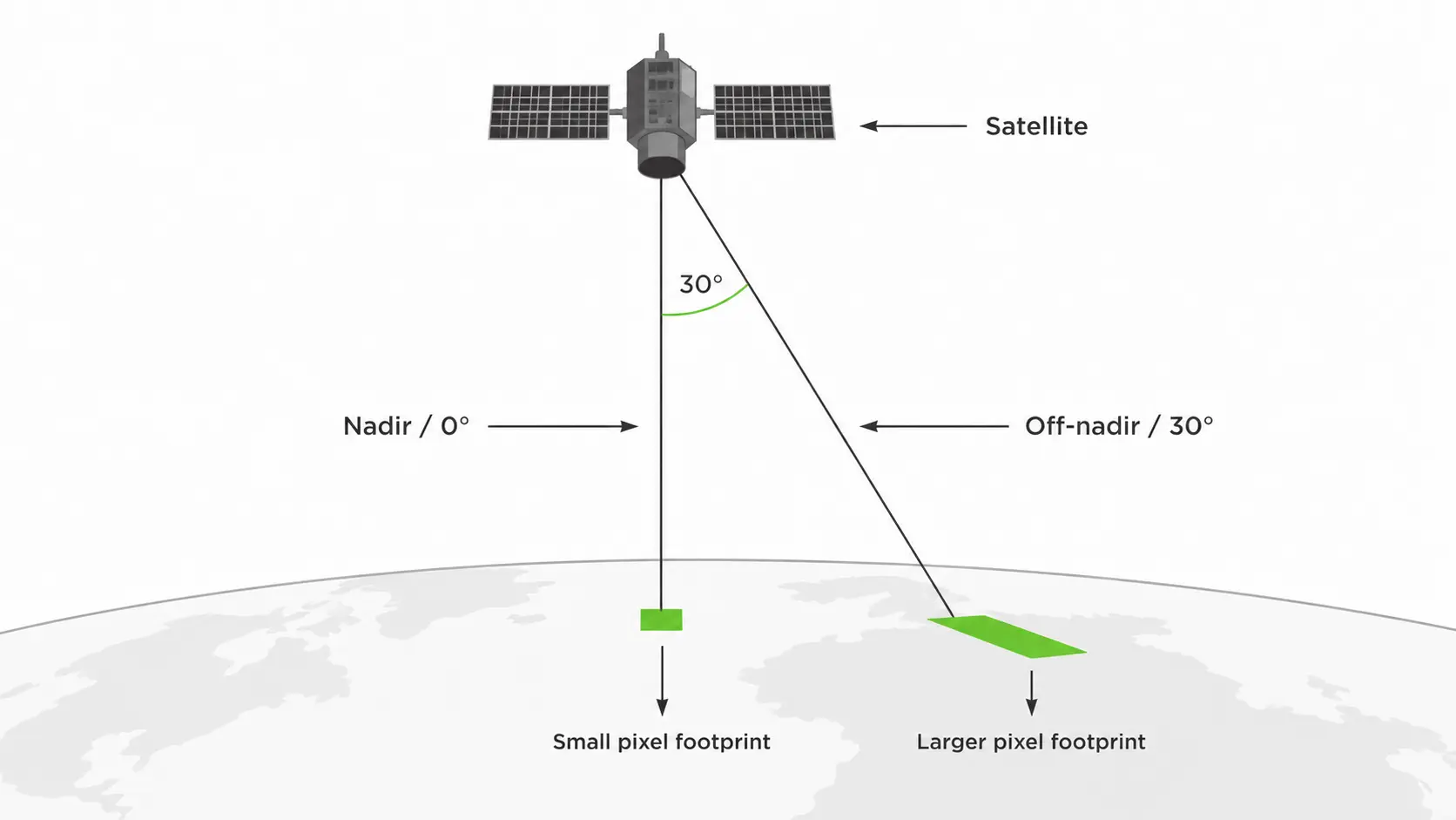
One key reason for GSD variation is viewing geometry. A VHR or VVHR satellite will often observe a target at an angle rather than looking directly downwards — this is called the off-nadir angle. Zero degrees represents a nadir view, directly beneath the satellite. As the off-nadir angle increases, each pixel covers a larger area of ground, increasing the effective GSD and reducing the usable detail in the image.
Terrain introduces another variable. Slopes, mountains and differences in elevation affect how the satellite viewing geometry translates onto the Earth’s surface. As a result, two images marketed at a similar resolution may not provide identical usable detail when acquired over varied terrain.
How does resolution relate to image interpretability?
For defence and security intelligence applications, another useful way to think about resolution is through image interpretability – what an analyst can actually detect, recognise or identify in the imagery.
The National Imagery Interpretability Rating Scale, or NIIRS, provides a framework for relating image quality to the interpretation tasks that can be performed. Rather than describing imagery solely by pixel size, NIIRS considers the level of detail that can meaningfully be interpreted.
Geometric accuracy and positional reliability in satellite data
Geometric accuracy describes how precisely the features in a satellite image correspond with their true locations on the Earth’s surface.
A specification such as CE90 below 5 metres means that 90 per cent of measured horizontal positions are expected to fall within a five-metre radius of their true location. This can be critical when satellite imagery must align accurately with maps, infrastructure data or other geospatial datasets.
Ortho correction is central to positional reliability. This process corrects distortions caused by satellite viewing angles, sensor geometry and terrain, producing an image that can be accurately used alongside other geospatial data.
Imagery may be ortho corrected by the satellite operator or by the end user. What matters is understanding whether correction has been applied and what Digital Elevation Model (DEM) was used. The accuracy and resolution of that elevation model can materially affect the final geometric quality of the data.
How to choose the right satellite data resolution
Selecting the right resolution begins with the question you need to answer. The race towards finer resolution is technically impressive, but commercial value does not come from collecting the smallest possible pixels. In practice, the decision involves matching your application against the resolution types that matter most for it.
- For large-area monitoring — such as environmental change, agricultural land use, or weather systems — Medium or Low Resolution imagery is typically sufficient and offers significant cost advantages.
- For activity monitoring — such as construction sites, port operations, or industrial facilities — High Resolution at 1 to 5 metres will usually deliver the required insight. Temporal resolution matters here too: frequent revisits may be more valuable than finer spatial detail.
- For detailed infrastructure assessment or urban mapping — where individual vehicles, structures or features must be distinguished — Very High Resolution is the appropriate starting point.
- For defence, intelligence and precision mapping — where the smallest possible features must be identified and measured — VVHR below 0.3 metres is warranted.
Sometimes that means VVHR. Often it does not. The right resolution is the one that delivers the required insight without paying for detail that adds no value.
Frequently Asked Questions
- What is spatial resolution in satellite imagery? Spatial resolution describes the level of detail visible in a satellite image, expressed as the ground area covered by a single pixel. A lower number — such as 0.3 metres — means finer detail; a higher number — such as 30 metres — means each pixel covers a larger area of ground.
- What is the difference between spatial and temporal resolution in satellite data? Spatial resolution refers to the level of detail in a single image. Temporal resolution refers to how frequently a satellite revisits and images the same location. Both matter: a high-spatial-resolution satellite that revisits an area once a month may be less useful for monitoring fast-changing activity than a medium-resolution satellite revisiting daily.
- What does GSD mean in satellite imagery? GSD stands for Ground Sample Distance — the distance between the centres of neighbouring pixels as measured on the ground. It is a more precise technical measure than a headline resolution figure, as it accounts for viewing angle and terrain. Two images described at the same resolution may have different effective GSDs depending on how they were collected.
- What is VVHR satellite imagery? VVHR, or Very Very High Resolution, refers to satellite imagery with a spatial resolution below 0.3 metres per pixel. At this level of detail, very fine features — such as individual vehicles, small structures, or surface markings — can be identified. VVHR imagery is primarily used in defence, intelligence, and precision mapping applications.
- What is ortho correction in satellite data? Ortho correction is a processing step that removes geometric distortions in satellite imagery caused by the viewing angle, sensor geometry, and terrain. The result is an orthorectified image that can be accurately overlaid with maps and other geospatial datasets. The quality of ortho correction depends significantly on the Digital Elevation Model (DEM) used in the process.
- What does CE90 mean in satellite imagery? CE90, or Circular Error 90, is a measure of positional accuracy. A CE90 of 5 metres means that 90 per cent of measured positions in the image are expected to fall within 5 metres of their true location on the ground. It is a standard specification used to define the geometric accuracy of satellite data products.
- What is spectral resolution in remote sensing? Spectral resolution refers to the number and width of the wavelength bands a sensor captures. A multispectral sensor records several defined bands — such as near-infrared or red-edge — providing information about vegetation health, water content or material composition that cannot be inferred from spatial detail alone.