Very high-resolution (VHR) geospatial data from Earth Observation (EO) satellites can be highly beneficial to effective and cost-efficient national water resources management. As populations continue to grow, demand for clean and secure water supply is an ever-greater challenge. New technology in space will be part of the answer.
Geospatial mapping and national water resources management
National water resources, including vital water pipeline networks, can be effectively and cost-efficiently monitored using geospatial mapping data from satellites. Such VHR satellite data is now very readily available and much more cost effective than in the past. Satellite data offers some clear advantages over traditional methods such as land-based inspection and aerial surveying. These traditional methods can be more expensive, more time-consuming and subject to a variety of operational limitations. Given such limitations it can take valuable time to mobilise and deploy land-based monitoring or inspection, whereas the new generation of Earth Observation satellites can be far more responsive and cover a much wider area. This means that monitoring can be undertaken more frequently, for example seasonally, rather than annually as is often the case with more traditional methods.
The benefits, of which pipeline network leak detection is one, are particularly achievable when part of a regularly-updated acquisition of geospatial mapping data as part of a National Spatial Data Infrastructure (NSDI). Normally the responsibility of a National Mapping Authority, this centrally managed database provides a national geospatial data stack – a highly valuable resource to agencies or businesses whose mandate covers water resources and related environmental monitoring and management.
Using satellite mapping for national water resources management
A regularly updated geospatial data stack is a rich source of national mapping data, empowering multiple government agencies and commercial companies to regularly monitor land conditions, water resources and the related infrastructure. VHR satellite data can be used to get a clear, detailed indication of local land conditions in areas where water resources and infrastructure are present. Change can be detected more rapidly so that remedial action can be taken. The very high spatial detail is particularly helpful for monitoring rural areas that are often less accessible, or more costly, to inspect on a regular basis.
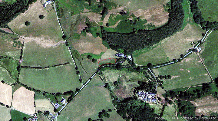
One rather simple, but quite effective, approach for detecting leakage from water infrastructure is to evaluate the comparable health and vigour of vegetation feeding off an otherwise hidden water leak. VHR satellite data enables analysis of vegetation health in very precise areas, producing a Normalised Difference Vegetation Index (NDVI) to identify the location of unusually vigorous vegetation in areas where water infrastructure is present.
NDVI exploits differences in the spectral reflectance of the red and near-infrared wavelengths, highlighting areas of increased vegetation vigour. Thriving versus ‘normal’ vegetation will show up in the assessment. The results of this analysis can then be mapped against the water pipeline spatial GIS layers to identify possible leaks where surrounding vegetation is unusually healthy compared to the prevailing conditions across the wider area. The locations of potential leaks can then be prioritised for ground inspection. Once a water distribution network is mapped semi-automated workflows can be established to allow regular and proactive checking to be put in place, potentially on a national scale.
Benefits from geospatial satellite mapping for national water resources management
The benefits of being able to rapidly detect and locate pipeline leaks are extensive, both from an economic, regulatory and societal aspect. Water loss can be reduced, damage to property, crops and water mains can be prevented, infrastructure can be proactively and quickly repaired, and health risks related to water contamination can be lowered.
Therefore, effective solutions using new technology from space could now help water authorities and companies make better use of their finite and variable resources. Readily accessible technology in space will enable them to achieve greater cost-efficiencies, prioritise infrastructure investment, strengthen environmental policies and ultimately build a more positive relationship with consumers, government agencies and tax-payers.
Such innovative use of geospatial mapping data from satellites is a major leap forward in terms of water resources management, and more widely, for land administration as a whole. This is why effective geospatial frameworks and geospatial data are significant contributors to the achievement of at least 13 of the 17 United Nation’s Sustainable Development Goals.
Read our e-Guide, Why geospatial mapping is important for the well-being of nations for more details on geospatial data and the benefits now available from very high-resolution satellite imagery.
To discuss how very high-resolution satellite technology can support pipeline leak detection projects or would like further information about wide area mapping, please contact us on enquiries@earthi.space.co.uk

