By Francesca Webb, Earth-i Summer Intern.
‘75% of the world’s population do not have access to formal systems to register and safeguard their land rights’
Highly developed nations have long-benefitted from sophisticated land administration systems. Now, they are reaping the rewards of their sustained investment in geospatial infrastructure. The populace of developing nations, in contrast, often lacks land rights or ownership; without an effective land administration system, land issues and inequalities remain a drag on economic growth and represent a barrier to the fulfilment of human rights. People suffer from a lack of security and economic bargaining power and society suffers from widespread injustice. Many nations recognise the need for change, and a ‘fit-for-purpose’ land administration system is a key priority for the National Mapping and Cadastral Authorities charged with creating a new geospatial framework for their nation.
Everything happens somewhere – location information underpins all information
The four core land administration strategies – land tenure, land value, land use, and land development – depend on geospatial data which is inclusive, accurate, attainable, and, critically, affordable. An up-to-date set of such geospatial data, within a National Spatial Data Infrastructure (NSDI), would provide decision-makers with a multi-dimensional tool for tackling poverty, improving social cohesion, and securing the environment for future generations. In reality, many developing nations face challenges creating and maintaining a reliable NSDI. Land-based surveying is expensive and time-consuming; remote sensing, whilst more affordable, has been less accurate. These nations are therefore reliant on their National Mapping and Cadastral Authorities (NMCA’s) and geospatial professionals to find more effective methods of gathering the much-needed data.
A ‘fit-for-purpose approach’ is needed
The International Federation of Surveyors (FIG) and the World Bank have called for a ‘fit-for-purpose’ approach. This would work by providing the geospatial data framework on which land administration, regulation and use management could sit, and from which core land administration strategies could be implemented. It is called ‘fit-for-purpose’ because it would meet the needs of a given region or society today, while being open to incremental improvements over the coming years. The concept demonstrates a high level of common sense and is of great importance for geospatial professionals who work with developing nations.
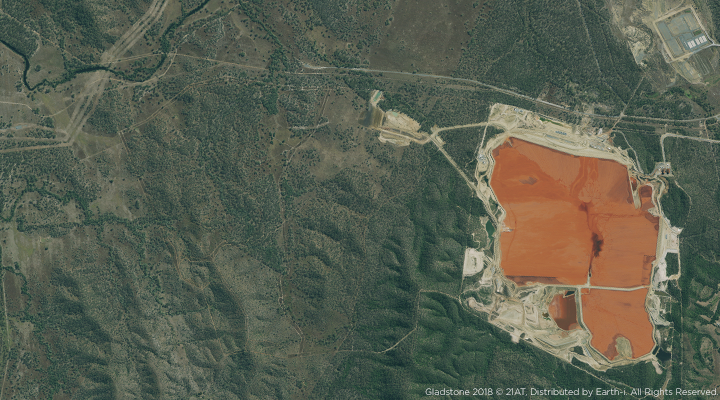
A new generation of commercial Earth Observation (EO) satellites has opened up a whole new world of spatial data acquisition
FIG and the World Bank identify the ‘key bottleneck’ for development of land administration services to be ‘the use of traditional, high accuracy, expensive land surveying techniques’. In addition, aerial survey and Unmanned Aerial Vehicles (UAVs) – whilst being able to deliver ultra-high resolution data – come with significant operational limitations and can be expensive. Free data from lower resolution EO satellites (such as Sentinel and Landsat) certainly offers wide-area mapping in a very affordable way. However, lower resolution data does not offer the depth of information required to deliver a fit-for-purpose geospatial data framework capable of addressing the breadth of land issues in many developing nations.
On the other hand, Very High Resolution (VHR) EO satellites are becoming increasingly affordable thanks to technological innovation and rapid growth in the commercial space sector. Improvements in technology and smaller satellite size has changed the economics of space, and more flexible and affordable launch options have also reduced the costs of putting satellites into space, making larger constellations commercially viable. Constellations, rather than single satellites or pairs, offer more tasking opportunities and the possibility for wide-area coverage, rapid data acquisition, and sub-1m spatial resolution; this is giving rise to improved levels of actionable detail, frequently up-dated. These new-generation satellites and constellations are at the forefront of providing accessible data and, as such, are fast-becoming the data source of choice for national mapping in developing countries. Indeed, many nations are already using VHR EO satellites for repeated monitoring and analysis of land use – effectively contributing to the development of an NSDI whose spatial data framework can be updated annually and affordably.
With effective use of space-based EO data and a ‘fit-for-purpose approach’, there is the potential for a future where all nations have access to a geospatial data framework which facilities good governance, economic growth. It is the goal of many national mapping and cadastral organisations and professionals to make this future a reality.
Would you like to discuss this with us further? Visit our e-Guide on ‘why geospatial data is integral to the wellbeing of nations’ or contact us.
Source reference: Published by International Federation of Surveyors (FIG)/World Bank Publication No. 60 2014 Fit-For-Purpose Land Administration


