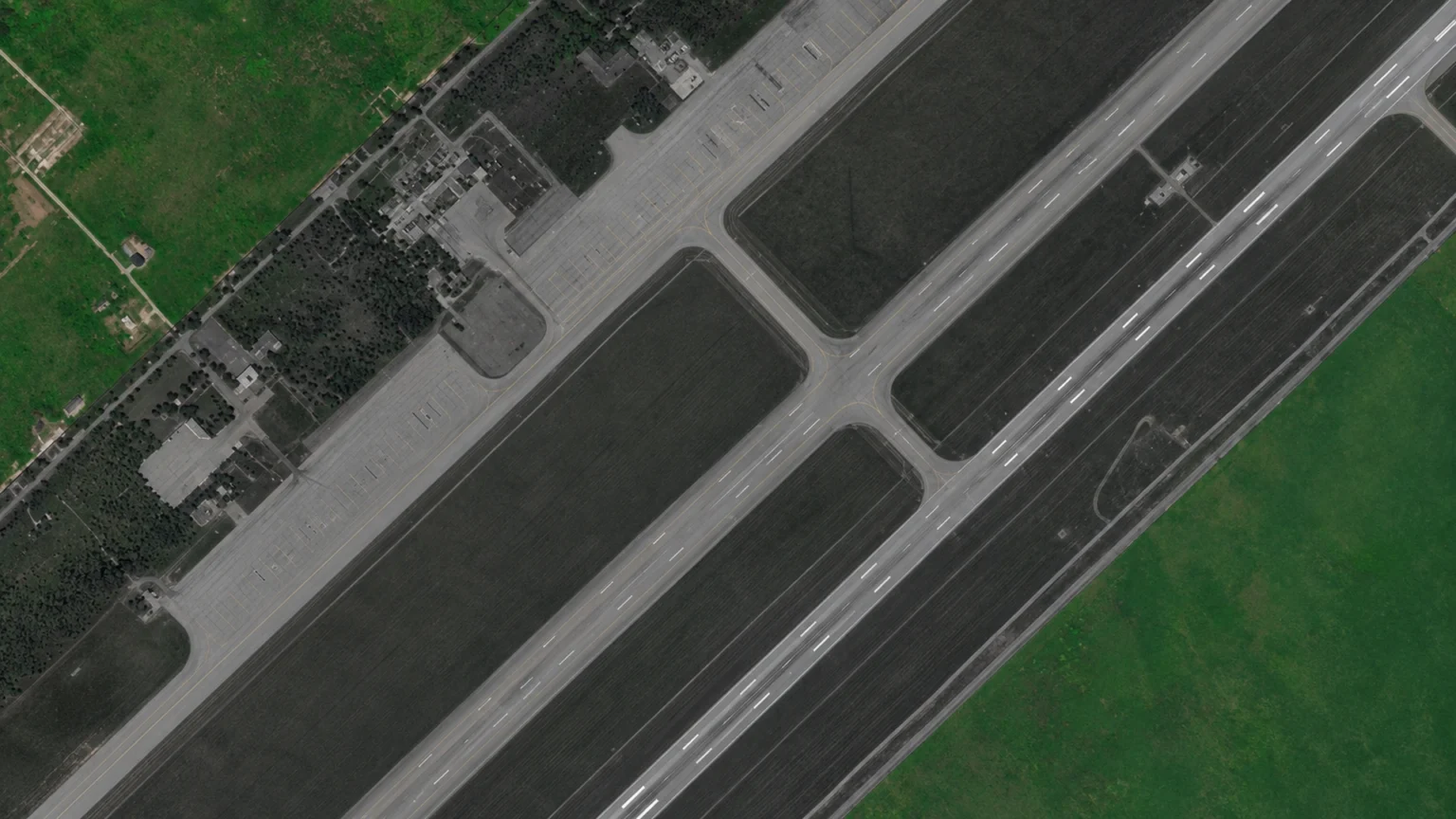
Military airfields are useful indicators of a country’s defence readiness and operational intentions. Changes in aircraft numbers, movements and airfield infrastructure can provide early signs of increasing or decreasing military activity as well as responses to recent events.
High frequency satellite monitoring is often the best way to identify if something unusual is worth a closer look. Using satellite monitoring and subsequent automated data workflows, military analysts can build an activity baseline from months or years of earlier imagery. In the finance industry these techniques allow imagery and intelligence analysts to back test their satellite intelligence against other intelligence sources to calculate and improve their confidence rating.
What counts as unusual activity at a military airfield?
Airfields rarely operate at a constant level of activity. Aircraft routinely arrive and depart, training exercises take place, and maintenance schedules affect how many aircraft are visible on the ground. The challenge for intelligence analysts is distinguishing these everyday fluctuations from activity that could indicate a significant change in military operations.
Indicators worth watching include:
- A sudden rise in aircraft numbers, particularly military
- Aircraft appearing at unfamiliar locations, or staying on the ground for unusually long periods
- A change in the number of support vehicles and other logistical assets
- New aircraft shelters, expanded apron areas or other construction work
- A sustained rise or fall in activity compared with the established pattern
Individually, these changes may have straightforward explanations. When several occur together, however, they can provide a stronger indication of unusual activity that requires further analysis. We cover the ground-force side of this in how satellites spot a build-up of military activity.
Establishing a baseline of normal activity
A valuable aspect of satellite monitoring is the ability to compare current observations with historical data. A single satellite image might show 30 military aircraft parked at an airfield. Without context, it is difficult to determine whether this represents routine activity or an unusual concentration.
By analysing imagery collected over months or years, intelligence teams can establish a baseline of normal operations, often described as a ‘pattern of life’.
This historical perspective allows analysts to understand typical aircraft numbers, identify recurring changes and assess whether new observations fall outside established patterns.
For example, a sudden increase in aircraft numbers might initially appear significant. Historical analysis could reveal that similar increases occur during annual training exercises. Alternatively, an unprecedented and sustained build-up could justify closer investigation.
The value comes from understanding how activity changes over time, rather than relying on isolated observations.
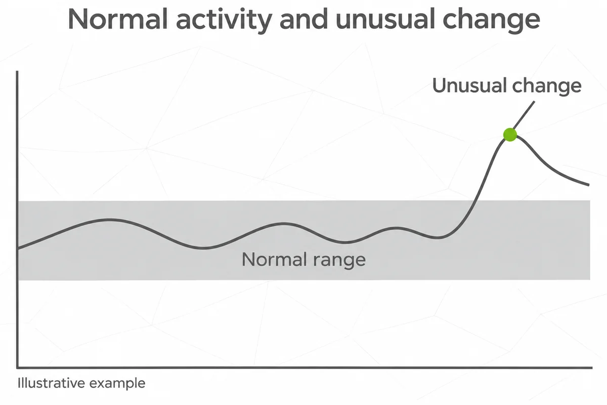
The following image illustrates a more detailed view of activity change on the ground delivered from Earth-i’s VANTAGE platform:
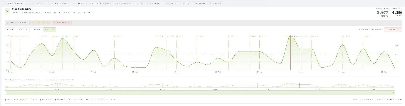
VANTAGE Platform – Area Of Interest (AOI) Activity Index – Highlighting Changes and Associated Events
Combining satellite data for more reliable intelligence
Different satellite sensors offer different advantages, and no single source provides a complete picture. Very high-resolution optical imagery can automatically identify and classify individual fixed and rotary wing aircraft and enable identification and classification. However, cloud cover and the intervals between satellite passes can limit its usefulness for regular monitoring.
Medium-resolution optical imagery offers more frequent observations, while synthetic aperture radar (SAR) can provide additional information regardless of daylight and through cloud cover. Thermal or infrared satellites can show which airfield assets are operational. Combining these sources, known as satellite data fusion, helps overcome the limitations of relying on individual sensors and satellite operators.
The following image is a multi-sensor Acquisition Timeline from VANATGE showing Area Of Interest SATINT Archive Visualisation:
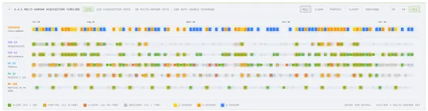
Earth-i demonstrated this approach when monitoring Taganrog Airbase in Russia. By combining data from several civilian satellite constellations, the company achieved coverage on 83% of days during a 31-day assessment period, despite cloud cover and gaps in individual datasets.
Knowing when upcoming satellites can be tasked to acquire imagery in a systematic and automated workflow is also valuable.
The following extract from VANTAGE shows the points at which different types of satellite data can be collected about a specific Area Of Interest.

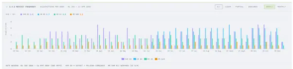
The different satellite acquisition times also provided opportunities to observe changes within the same day, demonstrating why revisit frequency can be as important as image resolution when monitoring military activity. Understanding a strategic area of interest’s satellite data collection history and the impact of seasonality helps understand how an airfield can be monitored.
The following extract from VANTAGE shows how frequently satellites collect imagery or intelligence data over a particular Area of Interest (AOI).
How AI identifies changes and anomalies
The growing availability of satellite imagery has created the problem of analysing large volumes of data and manually examining repeated observations across numerous military sites is resource-intensive and time-consuming.
AI and machine learning can automate much of this process, identifying and classifying objects, comparing successive observations and highlighting significant changes.
Earth-i has developed AI models capable of detecting and classifying military aircraft using commercial satellite imagery. These models can generate consistent aircraft counts and structured records that support historical comparisons.
Automated monitoring can then identify changes in aircraft numbers, the appearance of different aircraft types or unusual patterns of activity. Rather than reviewing every image individually, analysts can concentrate on the observations most likely to require attention.
Importantly, an automated alert does not necessarily indicate hostile intent. Satellite-derived findings need to be interpreted alongside other intelligence, operational context and known activity.
From satellite imagery to actionable intelligence
For defence organisations, the value of satellite monitoring lies in translating large volumes of imagery into information that supports timely decisions.
Our VANTAGE defence intelligence capability combines multi-source satellite data with AI-enabled analysis to support military asset monitoring, change detection and assessments of operational activity.
By processing observations from multiple satellite operators, Earth-i can help organisations maintain awareness across numerous airfields without relying exclusively on expensive, individually tasked high-resolution imagery.
Historical activity records, automated aircraft detection and change indicators provide analysts with a clearer understanding of what is happening at individual sites and how that activity compares with the past.
Improving military situational awareness
Military airfields provide valuable clues about operational readiness and possible changes in military posture. However, recognising unusual activity depends on consistent observation, reliable historical comparisons and informed interpretation.
By combining frequent satellite observations, multiple sensor types and automated analysis, defence organisations can detect changes earlier and assess their significance with greater confidence.